
Limited
Datahawk Flight Plan - (Not Available For Purchase)
Our Flight Plan software has now reached its 'end-of-life' after more than 35 years of use. It is no longer available to purchase. However, our company will continue to support this product for as long as it is practical to do so.
If any existing Flight Plan users with valid licence codes need to re-install our product, please contact us with your licence email address and we will send you a link to download the software. Thank you.
Flight Plan Operation Instructions
This is a fast and convenient flight planning application designed for checking and verifying your normal flight plan data when flying around New Zealand. This software was originally named 'Copilot-1' and was designed and written as far back as 1987. It has been completely rewritten for the latest Windows operating systems during 2007-08 and is now simply named 'Datahawk Flight Plan' (The original Copilot name has been reassigned to our comprehensive Flight School and Aero Club operations and accounting package).
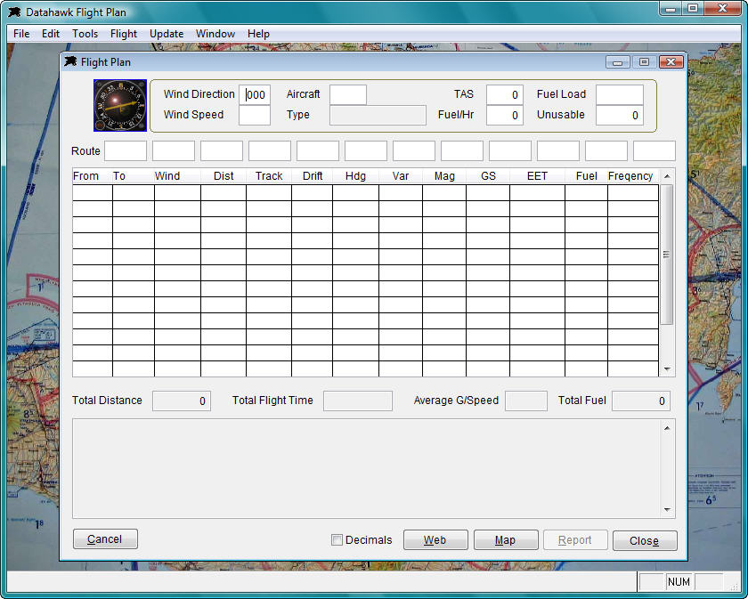
Initial program start up will produce a blank flight plan form similar to that displayed below. The screen shots displayed on this page were taken from a computer running Windows Vista. Please note that the underlying chart that can be seen in the following screen shots is only a background image for this program. This software does not contain any real time charting functions apart from the basic New Zealand route plotting map produced by the Map button. Future enhancements may be made to the mapping functions.
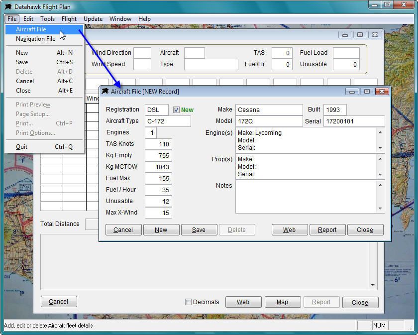
After you install the Flight Plan application you should set up at least one aircraft in the master file. You can use the program without a loaded aircraft but you will need to manually enter the Type, TAS, Fuel consumption, fuel load and unusable quantities manually. To add an aircraft, Click File, then Aircraft File from the menu and add your details...
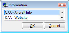
The 'Web' buttons located on the forms in this application will display various web link and location information details. The software comes with a built in database and it will be updated regularly by Datahawk. In the case of the aircraft master file, you will find information and web links pointing to aircraft data held by the NZ Civil Aviation Authority. These options will display a window with various web links and or contact information.
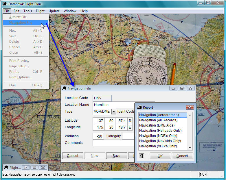
This software is supplied with a preloaded database containing most New Zealand aerodromes, heliports and navigation aids. We have checked these coordinates to the best of our ability against documents such as the NZ Civil Aviation listings and are happy that they are correct. However, position data may change or be amended without our knowledge and the database is open to you to enable editing or adding new destinations that you may require. With this in mind, you must accept that you use this data at your own risk and that you must always verify the flight plan output against your normal approved planning methods. You may access the Navigation File from the File menu. There are also several reports available from the Report button as shown in the example below.
OK, enough of the operation detail. To produce a flight plan, input the initial wind direction and wind speed, select the aircraft if you have loaded it, and fill in the aircraft data fields if this has not already been done for you by the program. Then simply enter your flight route in the 'Route' fields as per the sample below. The grid section will display the Distances, Tracks, Headings etc as you input the route codes. The database does not have the 'NZ' prefix loaded for locations to simplify the route input. The database is also set up with the letter 'V' after a location code to indicate a VOR location or the letter 'N' to use a NDB location (see below where the HN VOR is used and the WN NDB). The 'Web' button here will list useful information for aerodromes/airports, Aero Clubs, Flight Schools and various other relevant locations if desired.
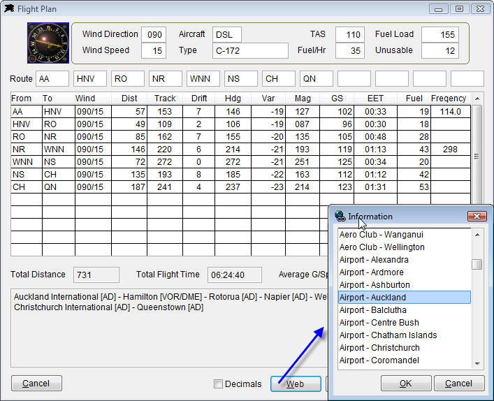
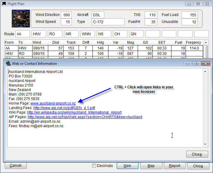
A sample display that follows is showing the contents of the Auckland Airport file. You may open the built in web links in you own browser by holding down a CTRL key and left clicking the mouse button.
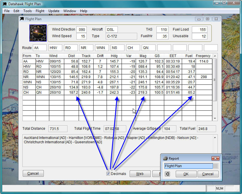
The flight plan grid is produced automatically while you input the route codes. You may then edit the wind direction and speed on any leg along with the variation and frequencies if desired. This form also has a tick box named Decimals. If you are seriously in to 'Precision Flying' or particularly obsessed with mathematics (like most software developers) then you can tick this box to recalculate the figures to one decimal place and include seconds of flight time.
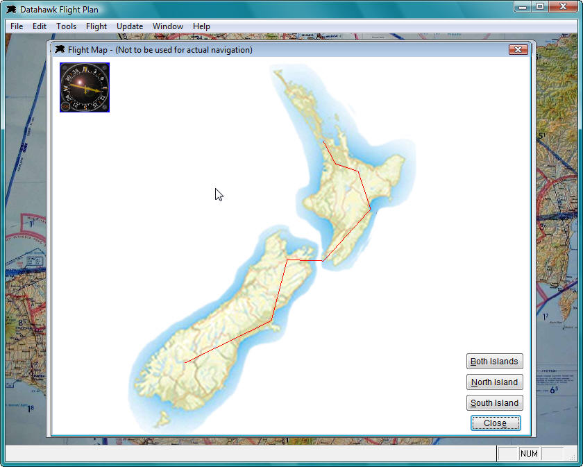
The 'Map' button will plot your route onto a basic map of New Zealand. This should alert you immediately if any coordinates are not correct.
The 'Report' button will produce a preview screen and allow you to print a flight plan / flight log if desired.
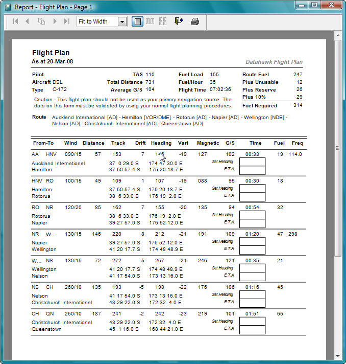
As you can see from this documentation flight plan output is fast and simple with no complications.
Caution - As pointed out in various places in this documentation and printed on the flight log form, this program is NOT designed to be used as your primary navigation source. The navigation database coordinates have been copied from publicly available information and this software allows you to modify and enter new flight plan locations as required. As such, the output produced from this software must not be used in place of your normal training or approved flight planning procedures.